 Hi Guest


McGregor
The village of McGregor was laid out in 1861, the population then totaling 50. In 1894 a village management board was established and in 1907 the village became a municipality. McGregor was originally known as Lady Grey, but the name was changed in 1905, to avoid confusion with Lady Grey near Aliwal North. It was renamed in honour of the Rev Andrew McGregor, who had been the Dutch Reformed Church minister of the Robertson District for forty years.
Ashton
With the completion of the railway line from Worcester to the coastal regions in 1887, the trading post, Roodewal, became a railway station, and shortly afterwards was renamed Ashton, in honour of Job Ashton, director and railway engineer of the New Cape Central Railways (Ltd), For several years the settlement consisted of only a railway station, warehouse, hotel, post office, butchery, a little school, one shop and a few houses. During 1939 and 1940 extraordinary growth took place with the opening of the Langeberg Co-
operative, resulting in the farmland being divided into plots. Development received a further boost with the establishment of a second canning factory in 1949. In 1956 Ashton gained municipal status.
Bonnievale
In 1902 a railway halt was constructed between Robertson and Swellendam and was called "Vale". In 1917 the halt received full status as a railway station and was then called Bonnievale. In 1922 a village management board was elected. The town received full municipal status in April 1953.
Montagu
Montagu, once known as "Agter Cogman's Kloof", lies between the Keisie and Klngna Rivers. The only exit to the west was through Cogman's Kloof, and strong teams of horses or oxen were needed for the journey. John Montagu, the British Secretary of the Cape Colony based in Cape Town in the 1850s, envisaged the potential of the Cape Colony, but realised that it could never develop without efficient transport and communications. Montagu was aided by pioneering road engineers to create passes through the mountain barriers. Through his efforts, the country could be developed agriculturally and he became a popular figure In Tribute to him the village was officially named Montagu in 1851 and he traveled there to "baptize" the town.
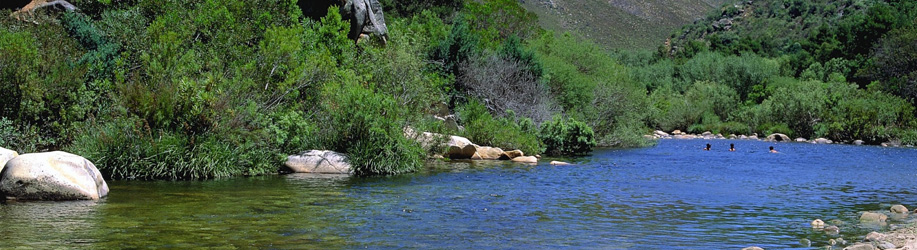
It is not known when the springs were discovered, but early trekkers offer- followed the course of rivers and some camped in the vicinity of present-day Montagu. They drank the clear, strangely-flavoured water, found it wonderfully refreshing and traced its course through the kloof to where they discovered the hot springs. News of the healing waters spread quickly and many visitors began to visit the area. The springs form part of the now popular Montagu Baths.
Robertson
Robertson was founded in 1853 and named after Dr Robertson, then pastor at Swellendam.
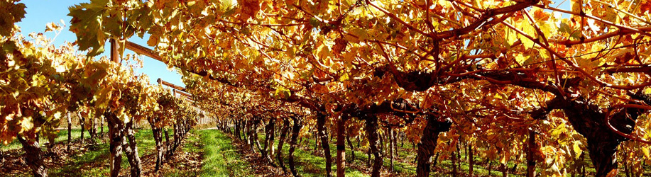
Robertson is one of the largest wine-producing regions in the Republic: its most famous product is dry white table wine. At the local KWV distillery there are 128 stills, which must make it the largest in the world. Another important Industry is the factory of Food and Nutritional Products (Pty) Ltd., which manufactures condensed milk, among other products.
Because of the area's relatively low rainfall, there is intensive irrigation. About 25 km of irrigation canals, leading from the Breede River, carry water that is pumped by electricity as far as Montagu. Robertson is South Africa's first irrigation district.
Although the rural area is in extent much larger than the urban areas, the majority of the population reside in urban areas. As the agriculture sector is currently experiencing economic difficulties, it is envisaged that more people will move to the urban areas to seek employment. The spatial implication of this is that the residential need in the towns will increase with subsequent pressure on resources such as water and energy.
Land needs to be identified for small-scale farmers. The area is characterised by low rainfall and therefore water is a fairly scarce commodity. Currently, rural and urban uses compete for this commodity.
The Keisie is currently a major fruit-producing valley. However, the rural community is amongst the poorest in the region. Another challenge for the valley is sufficient water supplies to support any further development. Because the economy of the area depends largely on agriculture people are subject to seasonal income. Living standards are lowered to a large extent during the off-season.
Problems within agriculture, such as the closure of production plants and factories, as well as surpluses in the wine industry, contribute to the poverty, situation. The region's potential for tourism is well known and recent studies have highlighted various options for development in this regard. It forms part of the well-known Route 62.
The mayor of the municipality is Charles Ntsomi of the ANC. It is divided into nineteen wards with a total of thirty-seven councillors.
The structure of the municipality has three distinct components:
• Political
• Administrative
• Public Participation Structures
The current political governance structures of the Municipality are as follows:
- Council
- Executive Mayor
- 4 x Portfolio Committees
- 10 x Ward Committees
The 10 Ward Committees as chaired by the relevant directly elected Ward Councillor. The 4 Portfolio
Committees are each chaired by a member of the Mayoral Committee. The IDP Representative Forum is chaired by the IDP Coordinator and includes representation from the 10 elected ward committees.
Adjacent municipalities
• Witzenberg Local Municipality (northwest)
• Cape Winelands District Management Area (north, east)
• Langeberg Local Municipality (southeast)
• Theewaterskloof Local Municipality, Overberg District Municipality (south)
• Stellenbosch Local Municipality (southwest)
• Drakenstein Local Municipality (west)
The Breede River/Winelands Local Municipality covers Robertson, Montagu, Ashton, McGregor and Bonnievale.
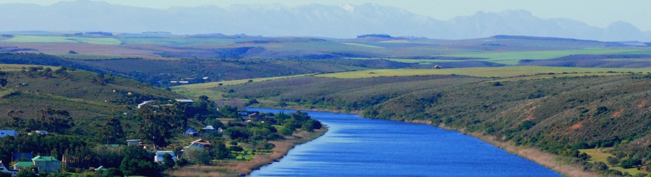
The valley stretches from McGregor in the south and Gouda in the west, to Montagu in the east and the Karoo in the north with the N1 passing virtually through its centre in a north easterly direction. It derives its name from the Breede River that rises in the mountains near Ceres and flows through the valley en route to the Indian Ocean and serves as the main water source for the Breede River Valley.
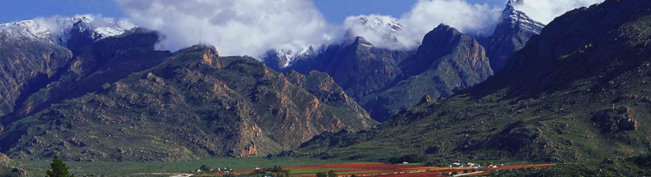
The Breede River Valley is relatively broad and flat for a Western Cape valley, averaging at a floor height of 80m-250m above sea-level. Western regions are mostly alluvial and flat, while eastern regions have more hills of the Bokkeveld Formation with narrow alluvial deposits. The valley was formed by its namesake, the Breede River. It is completely encircled by high mountains of the Cape Fold Belt ranging in height from 1500m to upwards of 2000m's. It stretches from Tulbagh in the north to McGregor in the south and Rawsonville in the west to Ashton and Bonnievale in the east.
Worcester
Worcester is the capital of the Breede River Valley, a fertile inland area referred to locally as “over the mountains”. This valley stretches from Gouda in the west and McGregor in the south, to Montagu in the east and the Karoo in the north. The Breede River Valley is the largest fruit and wine producing area in the Western Cape and is the leading race-horse breeding area in the country. This semi-arid area, which forms part of the Little Karoo, is known for its magnificent scenery and indigenous Fynbos and proteas.
Worcester was founded in 1822 after the amalgamation of two farms, Roodewal and Langerug. The town was named after the brother of Lord Charles Somerset, the Marquis of Worcester.
Worcester is just 90 minutes drive from Cape Town on the N1 highway running north to Johannesburg. With its wide range of service and commercial facilities including fast and efficient banking services, world-class telecommunications and many more, it has become the business and shopping centre not only for the nearby towns, but for the entire Breede River Valley.
Lying more inland than Cape Town behind the Du Toitskloof and Slanghoek Mountain ranges, Worcester experiences more extremes of temperature. Summers are generally dry and hot with maximum temperatures often exceeding 30ºC. Winters are usually very windy and often cool to cold with snowfalls common at the higher elevations. Worcester gets most of its average annual rainfall of 175mm in the winter. Most of the Breede River Valley has relatively abundant precipitation (ranging from 500mm to over 1,000mm per annum), but the town of Worcester is relatively dry as it lies in a curious rain-shadow phenomenon caused by the surrounding high mountains.
The town is surrounded by verdant valleys, wine farms and spectacular craggy mountains, the peaks of which are often covered with snow in the winter. With 24 co-operative and three private wine cellars along its Wine Route, the Worcester district is one of the most important wine-making areas in the country, producing 20% of South Africa’s wine! The region is also the country’s most important brandy producing area; Worcester is home to two Brandy Cellars – KWV, the world’s largest brandy cellar, and Olof Berg Solera Cellar.
The region also boasts private hospitals and clinics that provide fast and professional medical emergency assistance. Many specialist medical services are also available.
Not only is there a lot to see and do in Worcester, but its location makes it an ideal base from which to explore the surrounding towns, vineyards and valleys. From here you can visit interesting towns such as Tulbagh, Ceres, Robertson, Montagu and/or Touws River. Situated as it is between the Breede River and the Hex River Mountains to the north, Worcester and the Breede River Valley is a real eco-destination with its magnificent mountain scenery, breathtaking views, nature reserves, and unique Fynbos flora and fauna.
De Doorns
Approximately 140kms from Cape Town and 35kms from Worcester, in the centre of the beautiful, fertile Hex River Valley, lies the little town of De Doorns. De Doorns, which means “the thorns” in Dutch, gets its name from the Acacia thorn trees that used to dominate the Hex River Banks.
The Hex River Valley is situated between the Hex River or Matroos and Quado Mountains and is known as the home of the South African table grape industry as it has been producing and exporting grapes for over a century. Today the farms in the valley grow almost exclusively table grapes and export approximately 17 million cartons of grapes annually. The harvesting season runs from January until mid-April. De Doorns proudly accommodates the wine cellar with the longest harvest season in the world.
The Hex River Valley does not only host the Matroosberg – the highest mountain peak in the Western Cape (2,249m above sea-level) – but it is remarkably picturesque and serene being as it is a valley of vineyard upon vineyard, historical Cape Dutch homesteads, and snow-capped mountains during the winter. It is particularly scenic in the autumn when the vines give rise to a display of rich variegated colour.
The name “Hex”, derived from the Afrikaans word for witch, stems from an intriguing legend from the early days of the settlement of the valley in the 18th century of a fair ghost (the hex or witch) who is supposed to haunt the Hex River Mountains. Five of the original homesteads still stand as monuments to the early settlers and there are plenty of beautiful farms to stay and trails to explore in the area.
Although De Doorns has all the typical town services like schools, doctors, banks, supermarkets, etc, it is within a short travelling distance of the larger medical and shopping centres of Worcester, Paarl and Cape Town.
Rawsonville
Rawsonville is a small farming town set in the midst of the vineyards of the beautiful Breedekloof. The town’s economy relies heavily on serving the surrounding agricultural community, however, wine tourism and weekend retreaters are contributing more and more to the town’s income.
The Breedekloof starts as you exit the Huguenot tunnel. It encompasses the Goudini, Slanghoek, Breede River and Rawsonville areas and is one of the largest wine producing regions of the Western Cape. There are 13 wine cellars alone within a 10km radius of Rawsonville. These cellars do not only produce award-winning wines, but most of them also offer guided cellar tours, wine tasting and wine sales.
Rawsonville lies approximately 107kms east of Cape Town and about 15kms West of Worcester. “De Goudini School” and the town of Rawsonville was founded in 1858. The town was named after William Rawson, the then Colonial Secretary of the Cape Colony. There is often some confusion regarding these two names: Rawsonville is the name of the town itself, while Goudini refers to the surrounding area.
Wolseley
The towns of Wolseley and Breë River are situated in the Southern end of the picturesque Tulbagh Valley 14kms from Tulbagh, 15kms from Ceres, 40kms from Worcester and about 90 minutes drive from Cape Town. The towns are thus easily accessible, especially since visitors can take any one of four scenic passes – the Nuwekloof, Bainskloof, Du Toitskloof and Mitchell’s Passes – to reach them.
The area is blessed with abundant water and is surrounded by the majestic Waaihoek, Witzen and Waterval mountains, which are often covered with snow during the winter. Wolseley lies on a natural watershed that divides two major river systems – the Berg River that flows into the Atlantic Ocean and the Breede River that flows in the Indian Ocean. The town is also located in the heart of the Fynbos floral kingdom with unique plants that are endemic to the Western Cape.
Touws River
This little railway town, which is the divide between the Hex River Valley and the Central Karoo, is situated some 185kms east of Cape Town on the N1. As it lies on the edge of the Karoo in the foothills of the Matroosberg Mountains, Touws River is known as the ‘Gateway to the Karoo’.
Touws River is only an hour’s drive from Worcester – a town that offers great medical care, has a Mall with all the major chain stores, and excellent schools. De Doorns, with its extensive export table grape industry, is the nearest town to Touws River.
It is climatically diverse, however it completely falls within a Mediterranean Climate. Towards the north and west, rainfall approaches upwards of 1000mm p.a., particularly in the Slanghoek Region near Rawsonville, whilst it becomes drier towards the south and west, with most areas averaging 300mm p.a., with areas near Worcester only receiving 175mm p.a. Thus Karoo Shrub dominates eastern hills, with lush Fynbos vegetation dominating western regions.
The Breede Valley has a well-established economy based on strong agricultural, manufacturing and tourism sectors, as well as a well-developed commercial and service sector.
Worcester, surrounded by mountains, rivers and vineyards, is the center of business and finance in the Breede River Valley. The town has a lively economy, backed by well developed agricultural, manufacturing and tourism sectors. Being an important grape producer, Worcester produces about 25% of South Africa’s wine grapes of which 45% is being used for the distillery of brandy. The area is also known for its table grapes. A well developed infrastructure, strategic position (on the main road to Gauteng and the Southern Cape) ample water supply, serviced industrial sites and a safe environment make Worcester the ideal town for industrial investment.
The economy of Worcester functions primarily to serve its agricultural community. As such it is a transportation hub and an administrative centre. In the last couple of years several new developments have sprung up around the Worcester Dam, namely the Mountain Mill Shopping Mall; the Golden Valley Casino, hotel and conference centre, and various business and office developments.
Robertson then became famous for its ostrich industry, but the First World War put an end to this and farmers turned their attention to wine and fruit farming. There are also a number of world-renowned racehorse breeding estates that have been established here, which add to the area’s prosperous economy.
As of the census of 2001, there are 146,029 people and 34,099 households residing in the municipality. The population density is 48.76/km². The density of households is 11.39/km². The racial makeup of the municipality is Black African 20.13%, Coloured 65.61%, Indian/Asian 0.33%, and White 13.93%.
12.3% of all households are made up of individuals. The average household size is 4.28.
In the municipality the population is spread out with 29.9% under the age of 15, 19.0% from 15 to 24, 31.7% from 25 to 44, 14.7% from 45 to 64, and 4.5% who are 65 years of age or older. The median age is 25 years. For every 100 females there are 96.0 males. For every 100 females age 18 and over, there are 93.5 males.
In the municipality 80.5% of residents speak Afrikaans at home, 1.8% speak English, 0.0% speak Ndebele, 16.2% speak Xhosa, 0.0% speak Zulu, 0.0% speak Northern Sotho, 1.1% speak Sotho, 0.0% speak Tswana, 0.0% speak Swati, 0.0% speak Venda, and 0.0% speak Tsonga. 0.2% of the population speaks a non-official language at home.
91.6% of residents are Christian, 4.8% have no religion, 2.0% are Muslim, 0.0% are Jewish, and 0.0% are Hindu. 1.6% have other or undetermined beliefs.
8.8% of residents aged 20 and over have received no schooling, 22.6% have had some primary school, 9.2% have completed only primary school, 32.7% have had some high school education, 20.3% have finished only high school, and 6.3% have an education higher than the high school level. Overall, 26.6% of residents have completed high school.
49.2% of housing units have a telephone and/or cell-phone in the dwelling, 46.5% have access to a phone nearby, and 4.3% have access that is not nearby or no access. 86.5% of households have a flush or chemical toilet. 66.7% have refuse removed by the municipality at least once a week and 3.6% have no rubbish disposal. 61.5% have running water inside their dwelling, 87.8% have running water on their property, and 97.6% have access to running water. 84.4% of households use electricity for cooking, 75.4% for heating, and 89.6% for lighting. 73.9% of households have a radio, 70.8% have a television, 10.4% own a computer, 69.2% have a refrigerator, and 29.7% have a cell-phone.
12.7% of the population aged 15-65 is unemployed. Of the unemployed persons, 34.7% are Black African, 61.9% are Coloured, 0.2% are Indian/Asian, and 3.2% are White. 21.5% of Black Africans are unemployed, 12.1% of Coloureds, 7.4% of Indians/Asians, and 2.8% of Whites.
Worcester is a well-known educational centre boasting several schools, a college, and two world class schools for the disabled – the De La Bat School for the deaf and the Pioneer School for the blind. Worcester therefore has a relatively large disabled population with a few niche industries that supports them.
There are many schools in the area with Worcester Gymnasium probably the best known one.
Worcester Gymnasium
Worcester Gymnasium was founded in 1992 after the amalgamation of Worcester High School and Worcester East High School. Both these schools have a long history.
Worcester Campus
Boland College is a public Further Education and Training Institution. The College serves the extensive rural Boland region encompassing the Winelands, Overberg, Breede River Valley, Hex River Valley and Helderberg regions. Boland College comprises five campuses located in Caledon, Paarl, Stellenbosch, Strand and Worcester.
Boland College’s Worcester Campus is situated in the verdant Breede Valley, a region widely known for its exceptional scenic splendour and top quality sweet wines. Colourful vineyards, lush vegetation and majestic mountains meet the eye all round. The campus is close to the Worcester central business district, opposite the local government Department of Correctional Services.
It has three modern residences, with 24 hour security, which together house 300 female and male students. About 600 fulltime and 800 part-time students register each year for a variety of professional qualifications. The staff complement at the Worcester campus numbers 80. Skills programmes and learnerships, under the banner of a number of SETA’s, are also presented at this campus.
Sport
A variety of sporting activities is offered at Worcester Campus, such as athletics, cricket, rugby, netball, hockey, soccer, tennis and volley ball. Students compete at the summer and winter Inter-campus Sport Challenges against their fellow Boland College students from other campuses.
The Breede River Valley has low levels of crime.
Please note: This list only includes Businesses for sale in the Western Cape and not Franchises. Please click on the following link to view complete list of Franchises for sale in the Western Cape.
Please click here to view complete list of Franchises for sale in the Western Cape
| Ashton (0) | Bonnievale (0) | Ceres (0) | De Doorns (0) | McGregor (0) | Montagu (0) |
| Op die Berg (0) | Rawsonville (0) | Robertson (0) | Saron (0) | Tulbagh (0) | Wolseley (0) |
| Worcester (0) | Breede River Valley (0) |